
Digital Maps
A Word about Digital Map Design
Our digital maps are designed for viewing on a monitor or for projecting onto a screen. The resolution is 72 dpi and the map dimensions are typically either 1024x768 pixels or 1920×1080 pixels (the standard sizes for most LCD projectors or displays). Map labels are larger than those used in printed maps and the amount of information therefore is often reduced, both for reasons of space and because people cannot study a map projected onto a screen in the same way that they can study the details of a printed map.
Digital maps are ideal for teaching, presenting papers at scholarly meetings, and websites and blogs.
Samples
 |
|---|
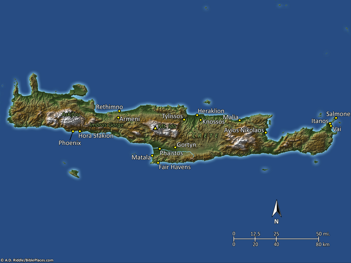
Map of Crete from Pictorial Library of Bible Lands, vol. 13.
|
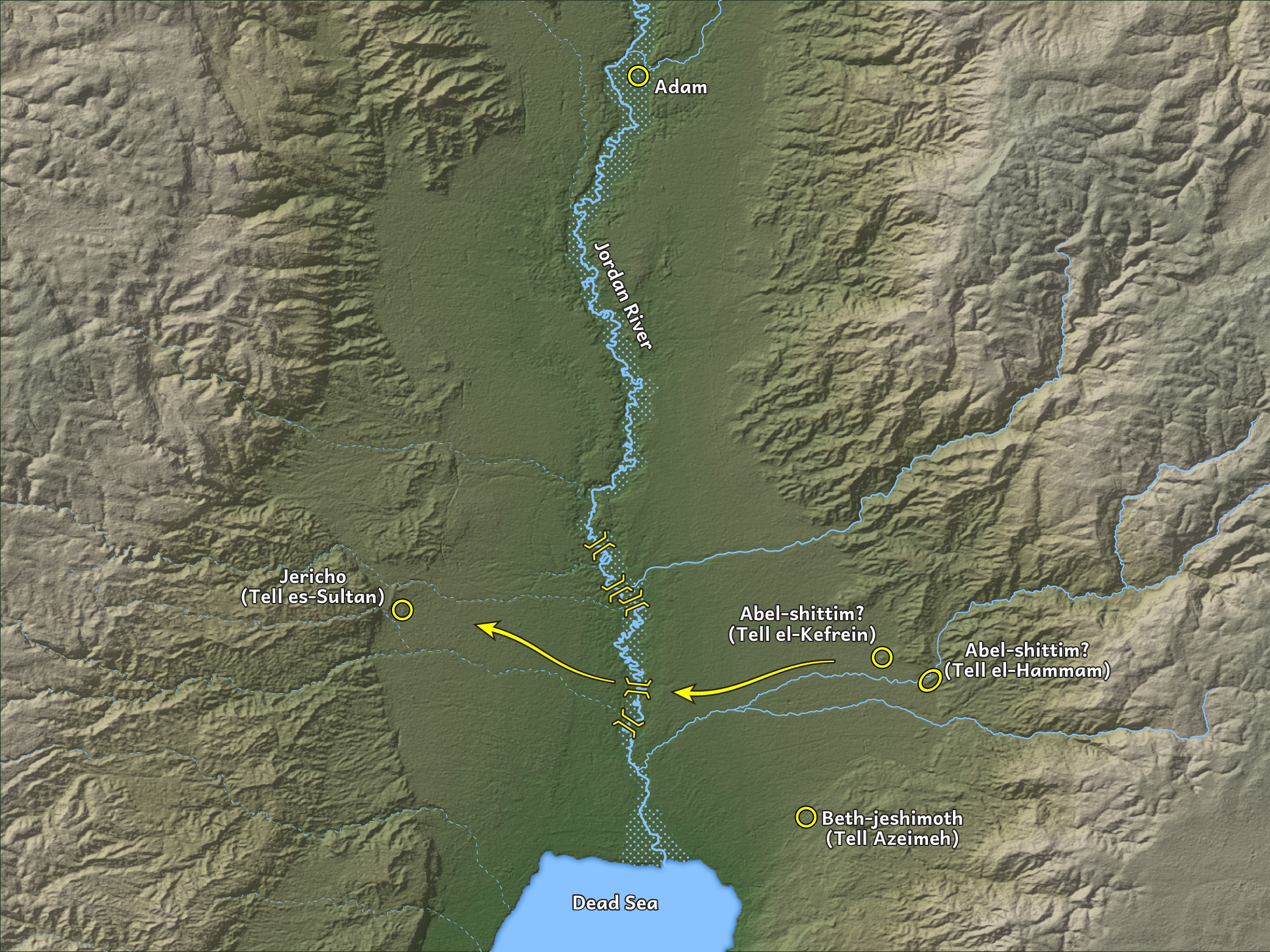 |
Map of Joshua 2 from Photo Companion to the Bible: Joshua.
|
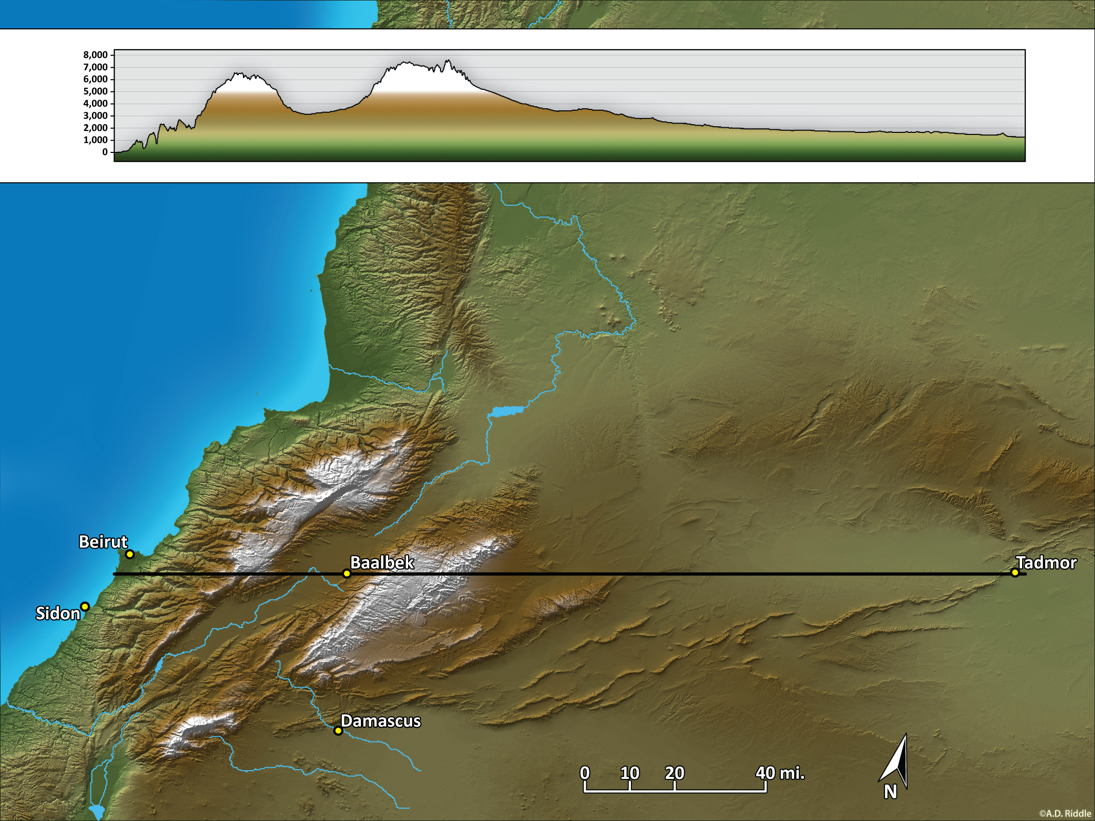 |
Topographic Profile Map from Beirut to Tadmor/Palmyra (prepared for a class lecture).
|
© 2021 A.D. Riddle