
Printed Maps
A Word about Printed Map Design
Our print maps are typically designed to be printed at 300 dpi, and can be black/white, grayscale, or full-color. The map scale, projection, and dimensions all depend on page layout and map extent. Print maps allow for smaller type size and therefore more information can be represented on a print map than on a digital map.
Print maps are ideal for books, atlases, school papers, handouts or fliers, and dissertations.
Samples
 |
|---|
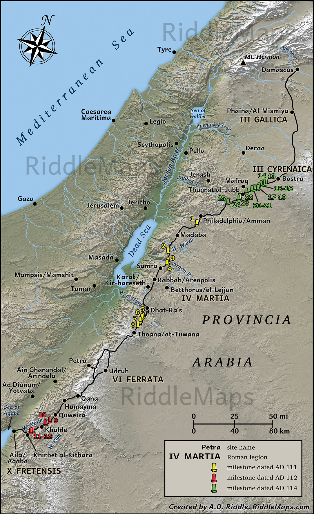
| Map of the Via Nova Traiana (prepared for a monograph). |
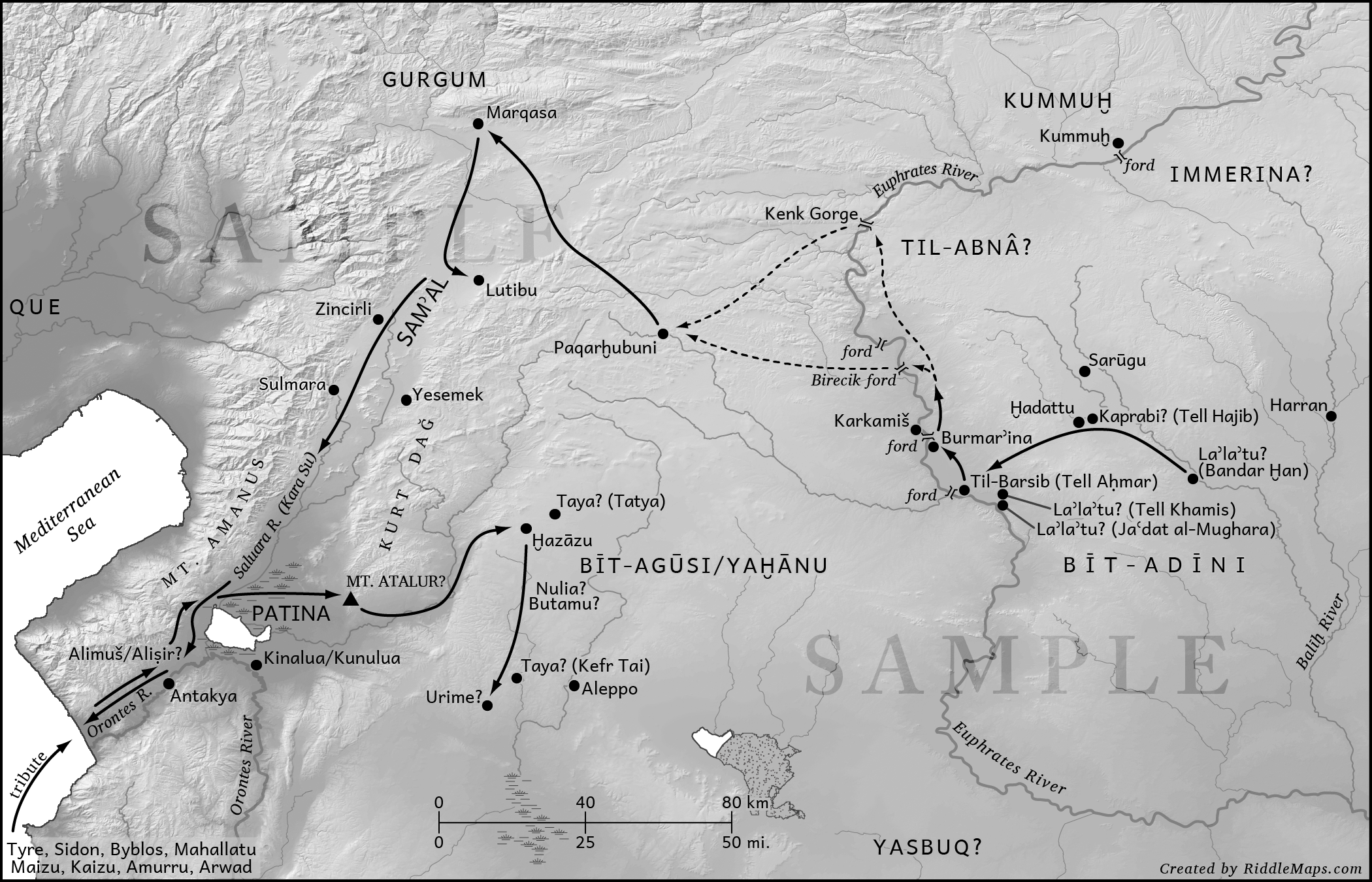 |
Map of Shalameser III's campaign in 858 BC (prepared for a published book).
|
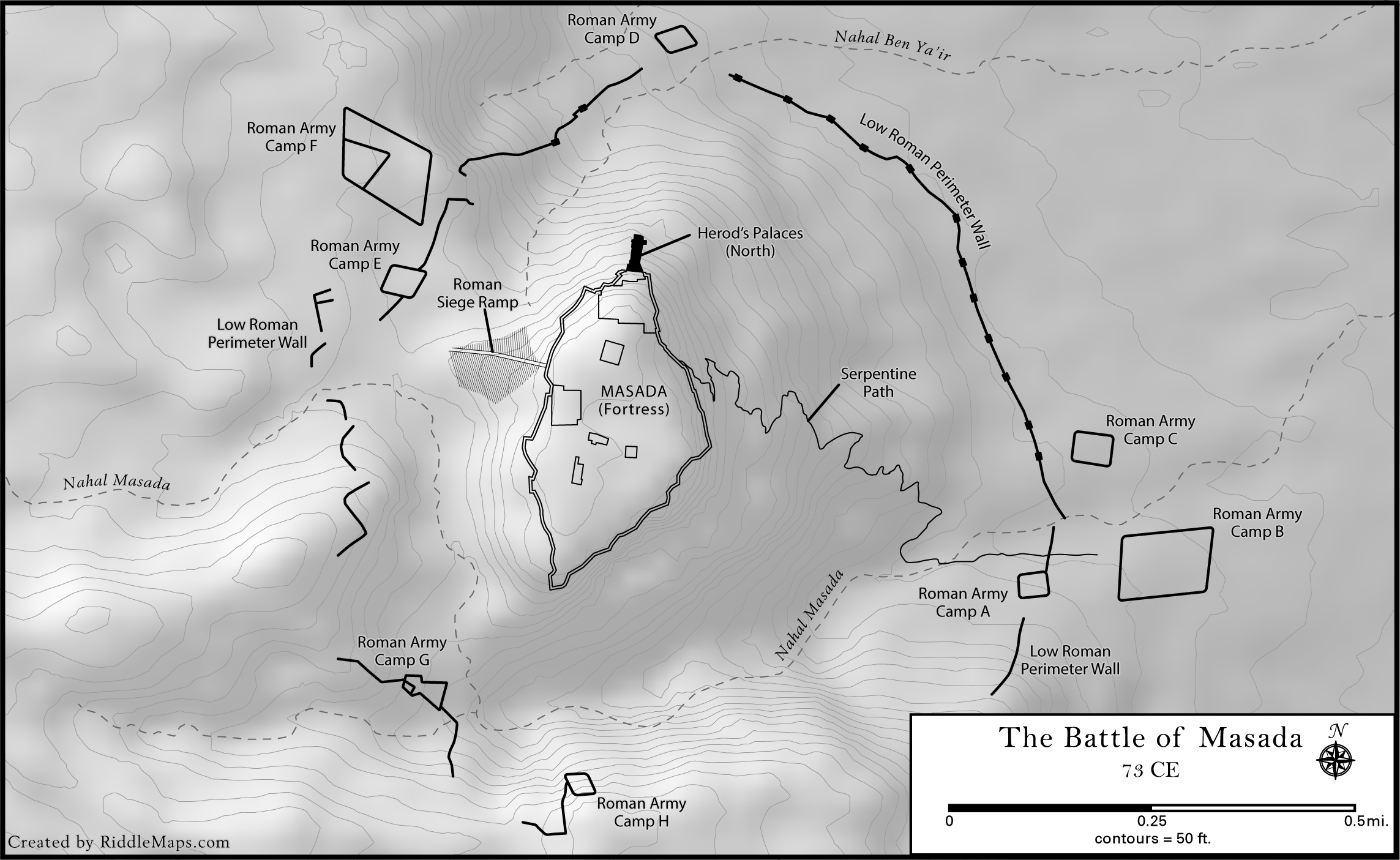 |
Map of the Roman siege of Masada (prepared for a published book).
|
Last updated: 06 Dec 2019
© 2019 A.D. Riddle